Výsledky vyhledávání

Autor: Mapseeker Publishing Ltd.
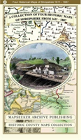
Shropshire 1611 – 1836 – Fold Up Map that features a collection of Four Historic Maps, John Speed’s County Map 1611, Johan Blaeu’s County Map of 1648, Thomas Moules County Map of 1836 and a Map of the Severn Valley Railway in 1887.The maps also feature a number of early views across Shropshire including the famous Ironbridge over the Severn and the Severn at Bridgnorth.
680 Kč
Bežná cena: 755 Kč
Sleva 10 %
(-10 %)
Na objednávku
Předpokládané dodání v pondělí, 10. června 2024
755 Kč -10 %
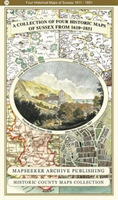
County of Sussex 1611 – 1836 – Fold Up Map that features a collection of Four Historic Maps, John Speed’s County Map 1611, Johan Blaeu’s County Map of 1648, Thomas Moules County Map of 1836 and a Plan of the City of Brighton from 1851 by John Tallis. The maps feature a number of vignette views from the period including Brighton’s Chain Pier.
680 Kč
Bežná cena: 755 Kč
Sleva 10 %
(-10 %)
Na objednávku
Předpokládané dodání v pondělí, 10. června 2024
755 Kč -10 %
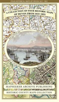
Devon 1611 – 1836 – Fold Up Map that features a collection of Four Historic Maps, John Speed’s County Map 1611, Johan Blaeu’s County Map of 1648, Thomas Moules County Map of 1836 and a Plan of Exeter 1851 by John Tallis.
680 Kč
Bežná cena: 755 Kč
Sleva 10 %
(-10 %)
Na objednávku
Předpokládané dodání v pondělí, 10. června 2024
755 Kč -10 %
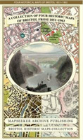
Bristol 1851-1903 - Fold up Map that consists of Four Detailed Street Plans, Bristol 1851 by John Tallis, 1866 by A Fullarton, 1893 by William MacKenzie and 1903 by Bartholomew.

Bristol 1851-1903 - Fold up Map that consists of Four Detailed Street Plans, Bristol 1851 by John Tallis, 1866 by A Fullarton, 1893 by William MacKenzie and 1903 by Bartholomew.

Mapseeker Publishing Ltd.
AngličtinaMapa na archu, složená
Historical Images Ltd
ISBN: 9781844918171
Na objednávku
Předpokládané dodání v pondělí, 10. června 2024
680 Kč
Bežná cena: 755 Kč
Sleva 10 %
(-10 %)
Na objednávku
Předpokládané dodání v pondělí, 10. června 2024
755 Kč -10 %
Somersetshire 1611 – 1836 – Fold Up Map that features a collection of Four Historic Maps, John Speed’s County Map 1611, Johan Blaeu’s County Map of 1648, Thomas Moules County Map of 1836 and a Plan of the City of Bath from 1851 by John Tallis. The maps feature a number of vignette views from the period.
680 Kč
Bežná cena: 755 Kč
Sleva 10 %
(-10 %)
Na objednávku
Předpokládané dodání v pondělí, 10. června 2024
755 Kč -10 %
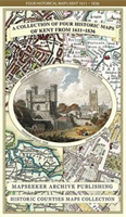
Kent County 1611 – 1836 – Fold Up Map that features a collection of Four Historic Maps, John Speed’s County Map 1611, Johan Blaeu’s County Map of 1648, Thomas Moules County Map of 1836 and a Plan of Canterbury 1806 by Cole and Roper.
680 Kč
Bežná cena: 755 Kč
Sleva 10 %
(-10 %)
Na objednávku
Předpokládané dodání v pondělí, 10. června 2024
755 Kč -10 %
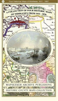
Middlesex 1611 – 1836 – Fold Up Map that features a collection of Four Historic Maps, John Speed’s County Map 1611, Johan Blaeu’s County Map of 1648, Thomas Moules County Map of 1836 and a Map of the Environs of London 1836.
680 Kč
Bežná cena: 755 Kč
Sleva 10 %
(-10 %)
Na objednávku
Předpokládané dodání v pondělí, 10. června 2024
755 Kč -10 %
Liverpool 1785-1903 - Fold up Map that includes Charles Eyes detailed Plan of the Township of Liverpool 1785, Cole and Ropers Plan of 1807, Bartholomew's Plan of 1903 and A Birds Eye View of Liverpool 1866.
680 Kč
Bežná cena: 755 Kč
Sleva 10 %
(-10 %)
Na objednávku
Předpokládané dodání v pondělí, 10. června 2024
755 Kč -10 %
Cambridgeshire 1611 - 1836 - Fold Up Map that includes Four Historic Maps of Cambridgeshire, John Speed's County Map of 1611, Johan Blaeu's County Map of 1648, Thomas Moule's County Map of 1836 and Thomas Moule's Plan of Cambridge City 1836
680 Kč
Bežná cena: 755 Kč
Sleva 10 %
(-10 %)
Na objednávku
Předpokládané dodání v pondělí, 10. června 2024
755 Kč -10 %
Mining & Manufacturing Districts 1836 Staffordshire and Worcestershire

Mining & Manufacturing Districts 1836 Staffordshire and Worcestershire

Mapseeker Publishing Ltd.
AngličtinaMapa na archu, složená
Historical Images Ltd
ISBN: 9781844918188
Na objednávku
Předpokládané dodání v pondělí, 10. června 2024
680 Kč
Bežná cena: 755 Kč
Sleva 10 %
(-10 %)
Na objednávku
Předpokládané dodání v pondělí, 10. června 2024
755 Kč -10 %
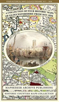
Gloucestershire 1611 – 1836 – Fold Up Map that features a collection of Four Historic Maps, John Speed’s County Map 1611, Johan Blaeu’s County Map of 1648, Thomas Moules County Map of 1836 and a Plan of Gloucester 1805 by Cole and Roper. The maps also feature three historic views of Gloucester from the 1840’s.
680 Kč
Bežná cena: 755 Kč
Sleva 10 %
(-10 %)
Na objednávku
Předpokládané dodání v pondělí, 10. června 2024
755 Kč -10 %
Derbyshire 1610 – 1836 – Fold Up Map that features a collection of Four Historic Maps, John Speed’s County Map 1611, Johan Blaeu’s County Map of 1648, Thomas Moules County Map of 1836 and Cole and Roper’s Plan of the City of Derby 1806. The map’s also features early views of Barlborough Hall, Doveridge House, Chatsworth House and Tissington Hall.
680 Kč
Bežná cena: 755 Kč
Sleva 10 %
(-10 %)
Na objednávku
Předpokládané dodání v pondělí, 10. června 2024
755 Kč -10 %
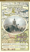
Essex 1610 – 1836 – Fold Up Map that features a collection of Four Historic Maps, John Speed’s County Map 1610, Johan Blaeu’s County Map of 1648, Thomas Moules County Map of 1836 and a Plan of Colchester 1805 by Cole and Roper.
680 Kč
Bežná cena: 755 Kč
Sleva 10 %
(-10 %)
Na objednávku
Předpokládané dodání v pondělí, 10. června 2024
755 Kč -10 %
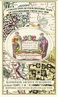
Oxfordshire 1611 – 1836 – Fold Up Map that features a collection of Four Historic Maps, John Speed’s County Map 1611, Johan Blaeu’s County Map of 1648, Thomas Moules County Map of 1836 and a Plan of Oxford 1836 by Thomas Moule. The maps also feature a number of Oxfords famous historic buildings.
680 Kč
Bežná cena: 755 Kč
Sleva 10 %
(-10 %)
Na objednávku
Předpokládané dodání v pondělí, 10. června 2024
755 Kč -10 %
Hampshire 1610 – 1836 – Fold Up Map that features a collection of Four Historic Maps, John Speed’s County Map 1611, Johan Blaeu’s County Map of 1648, Thomas Moules County Map of 1836 and a Plan of Winchester 1805 by Cole and Roper. The maps also feature three historic views from the 1840’s, Gosport, Men of War at Spithead and The Saluting Platform at Portsmouth.
680 Kč
Bežná cena: 755 Kč
Sleva 10 %
(-10 %)
Na objednávku
Předpokládané dodání v pondělí, 10. června 2024
755 Kč -10 %
Manchester 1650 - 1876 - Fold Up Map featuring William Swire's Plan of Manchester and Environs 1824, Cole and Ropers Plan of Manchester and Salford 1807, Dawson's Reform Plan of 1831, A Birds Eye View of 1876 Manchester and a Plan of Manchester of 1650
680 Kč
Bežná cena: 755 Kč
Sleva 10 %
(-10 %)
Na objednávku
Předpokládané dodání v pondělí, 10. června 2024
755 Kč -10 %
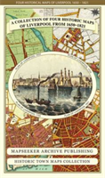
Liverpool 1650 to 1821 - Fold Up Map Containing Town Plans of Liverpool that include Liverpool 1650, 1725, 1795 and Sherwood's plan of Liverpool and Environs 1821

Liverpool 1650 to 1821 - Fold Up Map Containing Town Plans of Liverpool that include Liverpool 1650, 1725, 1795 and Sherwood's plan of Liverpool and Environs 1821

Mapseeker Publishing Ltd.
AngličtinaMapa na archu, složená
Historical Images Ltd
ISBN: 9781844918232
Na objednávku
Předpokládané dodání v pondělí, 10. června 2024
680 Kč
Bežná cena: 755 Kč
Sleva 10 %
(-10 %)
Na objednávku
Předpokládané dodání v pondělí, 10. června 2024
755 Kč -10 %
Cornwall 1611 – 1836 – Fold Up Map that features a collection of Four Historic Maps, John Speed’s County Map 1611, Johan Blaeu’s County Map of 1648, Thomas Moules County Map of 1836 and Robert Dawson’s Reform Act Plan of Truro 1831. The maps are surrounded by Cornwall’s Historic Buildings.
680 Kč
Bežná cena: 755 Kč
Sleva 10 %
(-10 %)
Na objednávku
Předpokládané dodání v pondělí, 10. června 2024
755 Kč -10 %
Aston Manor 1796 - Old map Supplied in a Clear Two Part Screw Presentation Tube - Print Size 45cm x 32cm

Aston Manor 1796 - Old map Supplied in a Clear Two Part Screw Presentation Tube - Print Size 45cm x 32cm

Mapseeker Archive Publishing Ltd
AngličtinaMěkká vazba
Historical Images Ltd
ISBN: 9781844917785
Na objednávku
Předpokládané dodání v pondělí, 10. června 2024
401 Kč
Bežná cena: 446 Kč
Sleva 10 %
(-10 %)
Na objednávku
Předpokládané dodání v pondělí, 10. června 2024
446 Kč -10 %
Bradshaw's Railway Map Great Britain and Ireland 1852

Bradshaw's Railway Map Great Britain and Ireland 1852

Bradshaw, George
AngličtinaMapa na archu, složená
Historical Images Ltd
ISBN: 9781844918041
Na objednávku
Předpokládané dodání v pondělí, 10. června 2024
680 Kč
Bežná cena: 755 Kč
Sleva 10 %
(-10 %)
Na objednávku
Předpokládané dodání v pondělí, 10. června 2024
755 Kč -10 %
James Drake's Street Plan and Index of Birmingham 1832

James Drake's Street Plan and Index of Birmingham 1832

Drake, James
AngličtinaMapa na archu, složená
Historical Images Ltd
ISBN: 9781844918133
Na objednávku
Předpokládané dodání v pondělí, 10. června 2024
680 Kč
Bežná cena: 755 Kč
Sleva 10 %
(-10 %)
Na objednávku
Předpokládané dodání v pondělí, 10. června 2024
755 Kč -10 %
Bradshaw's Railway Map Central Europe 1913

Bradshaw's Railway Map Central Europe 1913

Bradshaw, George
AngličtinaMapa na archu, složená
Historical Images Ltd
ISBN: 9781844918058
Na objednávku
Předpokládané dodání v pondělí, 10. června 2024
509 Kč
Bežná cena: 566 Kč
Sleva 10 %
(-10 %)
Na objednávku
Předpokládané dodání v pondělí, 10. června 2024
566 Kč -10 %
Collection of Four Historic Maps of Norfolk from 1611 - 1836

Collection of Four Historic Maps of Norfolk from 1611 - 1836

Mapseeker Archive Publishing Ltd, Mapseeker Archive Publishing Ltd
AngličtinaMěkká vazba
Historical Images Ltd
ISBN: 9781844918461
Na objednávku
Předpokládané dodání v pondělí, 10. června 2024
680 Kč
Bežná cena: 755 Kč
Sleva 10 %
(-10 %)
Na objednávku
Předpokládané dodání v pondělí, 10. června 2024
755 Kč -10 %